
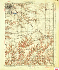
1937 Map of Jacksonville
USGS Topo · Published 1937About this map
Jacksonville serves as the primary hub of this west-central Illinois landscape, where multiple rail lines including the Wabash RR and the Alton RR converge. The city's northern edge is anchored by the Douglas Institute, while the nearby Mauvaise Terre Lake and Mauvaise Terre Creek define the local drainage patterns. Moving south into the rural townships, the map reveals a dense network of country education and faith, represented by dozens of named landmarks like Sulphur Springs Sch and Salem Ch.
Find a feature on this map
84 named features on this map. Tap any name to fly to it.
Don’t see what you’re looking for? This feature index may not catch every label — zoom into the map to look around manually.
Map Details
Editions of this 1937 Jacksonville Map
2 editions found
Other maps of this area

1909 · Tallula
USGS Topo · 1:62,500

1923 · Carlinville
USGS Topo · 1:48,000

1924 · Winchester
USGS Topo · 1:48,000

1924 · Waverly
USGS Topo · 1:62,500

1924 · Roodhouse
USGS Topo · 1:62,500

1925 · Carlinville
USGS Topo · 1:62,500

1926 · Winchester
USGS Topo · 1:62,500

1926 · Waverly
USGS Topo · 1:62,500

1926 · Roodhouse
USGS Topo · 1:62,500

1929 · Arenzville
USGS Topo · 1:62,500