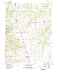
1971 Map of Jacksonville
USGS Topo · Published 1986About this map
The Norfolk and Western railroad corridor serves as the primary spine for this northern Randolph County landscape, connecting the settlements of Jacksonville and Cairo. This 1971 field-checked survey reveals a rural Missouri environment defined by agriculture and local industry, prominently featuring a Strip Mine west of the rail line. Several burial sites, including Jacksonville Cem, Colter Cem, and Union Cem, provide vital spatial data for genealogists tracing family histories across these townships.
Find a feature on this map
24 named features on this map. Tap any name to fly to it.
Don’t see what you’re looking for? This feature index may not catch every label — zoom into the map to look around manually.
Map Details
Editions of this 1971 Jacksonville Map
2 editions found
Other maps of this area

1890 · Moberly
USGS Topo · 1:125,000

1890 · Glasgow
USGS Topo · 1:125,000

1908 · Macon
USGS Topo · 1:62,500

1910 · Macon
USGS Topo · 1:62,500

1952 · Middle Grove
USGS Topo · 1:24,000

1953 · Moberly
USGS Topo · 1:250,000

1953 · Huntsville
USGS Topo · 1:24,000

1953 · Bevier South
USGS Topo · 1:24,000

1953 · College Mound
USGS Topo · 1:24,000
1953 · Moberly
USGS Topo · 1:24,000