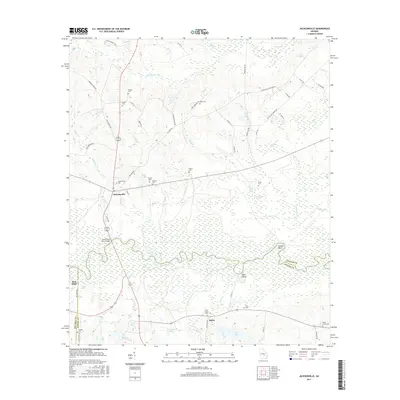
2017 Map of Jacksonville
USGS Topo · Published 2017About this map
The Ocmulgee River winds through the heart of this landscape, marking the southern border of Telfair Co where it meets Coffee Co. This waterway has long defined local commerce and movement, evidenced by the Jacksonville Ferry Bridge crossing south of the town of Jacksonville. The settlement patterns here are deeply rooted in family history and local industry, with numerous small burial grounds such as Graham Cem, Larkey Cem, and Wilcox Cem scattered across the undulating terrain north of the river.
Find a feature on this map
78 named features on this map. Tap any name to fly to it.
Don’t see what you’re looking for? This feature index may not catch every label — zoom into the map to look around manually.
Map Details
Editions of this 2017 Jacksonville Map
This is the sole edition of this map. No revisions or reprints were ever made.
Other maps of this area

1953 · Waycross
USGS Topo · 1:250,000

1958 · Waycross
USGS Topo · 1:250,000

1971 · Jacksonville NE
USGS Topo · 1:24,000

1971 · Snipesville
USGS Topo · 1:24,000

1971 · Broxton NE
USGS Topo · 1:24,000

1972 · Cooks Still
USGS Topo · 1:24,000

1972 · Broxton North
USGS Topo · 1:24,000

1972 · Jacksonville
USGS Topo · 1:24,000

1972 · China Hill
USGS Topo · 1:24,000
1972 · Workmore
USGS Topo · 1:24,000