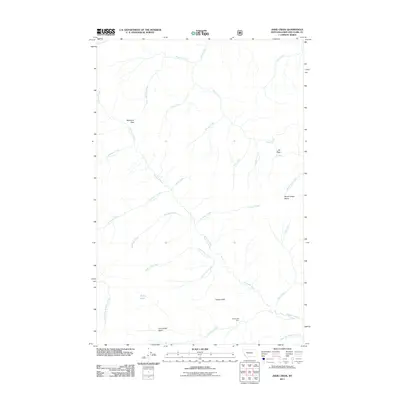
2011 Map of Jakie Creek
USGS Topo · Published 2011About this map
The Dearborn River snakes through this high-altitude landscape in Lewis and Clark County, joined by a dense network of mountain tributaries. The terrain is defined by dramatic elevation changes, notably at Welcome Pass and Elk Pass, which serve as natural transit points between drainages. The Grassy Hills dominate the southeastern quadrant, where the Grassy Hills Cabin stands as a solitary named structure in an otherwise undeveloped area.
Find a feature on this map
29 named features on this map. Tap any name to fly to it.
Don’t see what you’re looking for? This feature index may not catch every label — zoom into the map to look around manually.
Map Details
Editions of this 2011 Jakie Creek Map
This is the sole edition of this map. No revisions or reprints were ever made.
Other maps of this area

1903 · Coopers Lake
USGS Topo · 1:125,000

1955 · Choteau
USGS Topo · 1:250,000

1957 · Choteau
USGS Topo · 1:250,000

1958 · Choteau
USGS Topo · 1:250,000

1962 · Choteau
USGS Topo · 1:250,000

1968 · Heart Lake
USGS Topo · 1:24,000

1968 · Olson Peak
USGS Topo · 1:24,000
1968 · Caribou Peak
USGS Topo · 1:24,000
1970 · Scapegoat Mountain
USGS Topo · 1:24,000
1970 · Steamboat Mountain
USGS Topo · 1:24,000