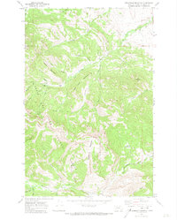
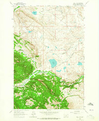
1970 Map of Steamboat Mountain
USGS Topo · Published 1973About this map
Steamboat Mountain dominates this portion of the Lewis and Clark National Forest, rising above a complex network of high-country drainages. The landscape is defined by the sharp relief between peaks like Lone Chief Mountain and the deep incisions of the Dearborn River and Elk Creek. This 1970 survey records a backcountry world accessible primarily via pack trails and jeep trails, where remote outposts like Elk Creek Ranch, Sky High Ranch, and the C Barn Camp provide the only signs of human habitation. The hydrological complexity is evident in features such as Cataract Falls and the confluence of numerous named streams like Cyanide Creek and Sawmill Creek. Geologic and topographic landmarks including Devils Glen, Bailey Basin, and Twin Buttes illustrate the transition from high alpine summits to more open terrain near Beaver Meadows.
Find a feature on this map
33 named features on this map. Tap any name to fly to it.
Don’t see what you’re looking for? This feature index may not catch every label — zoom into the map to look around manually.
Map Details
Editions of this 1970 Steamboat Mountain Map
2 editions found
Other maps of this area

1903 · Coopers Lake
USGS Topo · 1:125,000

1943 · Hogan
USGS Topo · 1:125,000

1955 · Choteau
USGS Topo · 1:250,000

1957 · Choteau
USGS Topo · 1:250,000

1958 · Choteau
USGS Topo · 1:250,000

1962 · Choteau
USGS Topo · 1:250,000
1963 · Blowout Mountain
USGS Topo · 1:24,000
1963 · Augusta
USGS Topo · 1:24,000
1963 · Bean Lake
USGS Topo · 1:24,000

1968 · Heart Lake
USGS Topo · 1:24,000