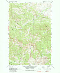
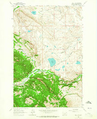
1970 Map of Steamboat Mountain
USGS Topo · Published 1991About this map
Steamboat Mountain dominates the high-altitude landscape of this 1970 survey, anchoring a rugged section of the Lewis and Clark National Forest. The map documents a topography defined by steep drainages and isolated outposts, where the Dearborn River winds through the southern reaches near Devils Glen. Evidence of human activity is concentrated in remote camps and grazing sites, such as Elk Creek Ranch and O Bar N Camp, connected by a network of pack trails and forest roads.
Find a feature on this map
33 named features on this map. Tap any name to fly to it.
Don’t see what you’re looking for? This feature index may not catch every label — zoom into the map to look around manually.
Map Details
Editions of this 1970 Steamboat Mountain Map
2 editions found
Other maps of this area

1903 · Coopers Lake
USGS Topo · 1:125,000

1943 · Hogan
USGS Topo · 1:125,000

1955 · Choteau
USGS Topo · 1:250,000

1957 · Choteau
USGS Topo · 1:250,000

1958 · Choteau
USGS Topo · 1:250,000

1962 · Choteau
USGS Topo · 1:250,000
1963 · Blowout Mountain
USGS Topo · 1:24,000
1963 · Augusta
USGS Topo · 1:24,000
1963 · Bean Lake
USGS Topo · 1:24,000

1968 · Heart Lake
USGS Topo · 1:24,000