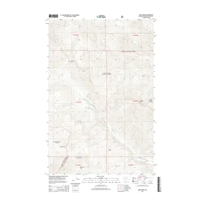
2014 Map of Jakie Creek
USGS Topo · Published 2014About this map
The Dearborn River cuts a deep path through the Lewis and Clark Range, dominating the central drainage of this high-elevation landscape in Lewis and Clark County. This 2014 survey documents a rugged wilderness at the junction of the Lewis & Clark National Forest and the Lolo National Forest. The map detail is particularly useful for locating remote geological transitions, such as the Tobacco Valley and the Grassy Hills to the south. Numerous creek systems, including Lost Cabin Cr and Jakie Cr, feed into the primary river channel, reflecting a complex watershed that has long defined access through these mountains. High passes like Welcome Pass and Elk Pass mark the traditional transit points between basins, while Twin Lakes provides a notable landmark within the dense forest boundaries.
Find a feature on this map
36 named features on this map. Tap any name to fly to it.
Don’t see what you’re looking for? This feature index may not catch every label — zoom into the map to look around manually.
Map Details
Editions of this 2014 Jakie Creek Map
This is the sole edition of this map. No revisions or reprints were ever made.
Other maps of this area

1903 · Coopers Lake
USGS Topo · 1:125,000

1955 · Choteau
USGS Topo · 1:250,000

1957 · Choteau
USGS Topo · 1:250,000

1958 · Choteau
USGS Topo · 1:250,000

1962 · Choteau
USGS Topo · 1:250,000

1968 · Heart Lake
USGS Topo · 1:24,000

1968 · Olson Peak
USGS Topo · 1:24,000
1968 · Caribou Peak
USGS Topo · 1:24,000
1970 · Scapegoat Mountain
USGS Topo · 1:24,000
1970 · Steamboat Mountain
USGS Topo · 1:24,000