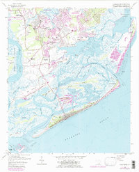
1959 Map of James Island
USGS Topo · Published 1984About this map
James Island and its surrounding marshlands are documented here just before the era of intensive coastal development, showing the transition from agricultural and rural pockets into suburban neighborhoods. The historical significance of Secessionville remains prominent, situated amidst a complex network of waterways including Secessionville Creek and Lighthouse Creek. To the south, the barrier islands and tidal flats define the coastline, with Folly Beach showing its mid-century footprint along Ashley Ave. A maritime and military presence is evident through the Loran Coast Guard Station and Loran Tower near Rat Island. Local community life is anchored by institutions like St James Ch, the James Island High Sch, and the Carolina Skyways Landing Field, while the northern edge of the map reveals the southern expansion of Charleston.
Find a feature on this map
68 named features on this map. Tap any name to fly to it.
Don’t see what you’re looking for? This feature index may not catch every label — zoom into the map to look around manually.
Map Details
Editions of this 1959 James Island Map
4 editions found
Other maps of this area

1918 · Kiawah Island
USGS Topo · 1:21,120

1919 · Johns Island
USGS Topo · 1:21,120

1919 · The Jetties
USGS Topo · 1:21,120

1919 · Wadmelaw Island
USGS Topo · 1:62,500

1919 · Charleston
USGS Topo · 1:21,120

1919 · James Island
USGS Topo · 1:21,120

1919 · Fort Moultrie
USGS Topo · 1:21,120

1919 · Legareville
USGS Topo · 1:21,120

1920 · Ravenels
USGS Topo · 1:62,500

1943 · Fort Moultrie
USGS Topo · 1:24,000