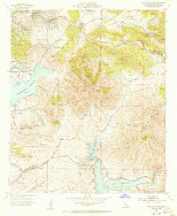
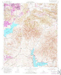
1955 Map of Jamul Mountains
USGS Topo · Published 1956About this map
San Miguel Mountains and the Jamul Mountains dominate this mid-century landscape of San Diego County, illustrating a period of transition from traditional ranching to suburban expansion. The Sweetwater River and its massive Sweetwater Reservoir define the western geography, while the Jamul Conduit traces a path through the eastern canyons. Large landholdings like Monte Vista Ranch, Ivanhoe Ranch, and Fenton Ranch reflect the region's agricultural heritage before the intensification of modern development.
Find a feature on this map
58 named features on this map. Tap any name to fly to it.
Don’t see what you’re looking for? This feature index may not catch every label — zoom into the map to look around manually.
Map Details
Editions of this 1955 Jamul Mountains Map
5 editions found
Other maps of this area

1893 · El Cajon
USGS Topo · 1:62,500

1901 · Elcajon
USGS Topo · 1:62,500

1903 · Cuyamaca
USGS Topo · 1:125,000

1903 · La Jolla
USGS Topo · 1:62,500

1903 · Elcajon
USGS Topo · 1:62,500

1904 · San Diego
USGS Topo · 1:62,500

1904 · Southern California Sheet No. 2
USGS Topo · 1:250,000

1930 · La Jolla
USGS Topo · 1:62,500

1930 · San Diego
USGS Topo · 1:62,500

1939 · El Cajon
USGS Topo · 1:62,500