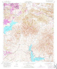
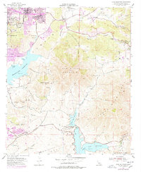
1955 Map of Jamul Mountains
USGS Topo · Published 1987About this map
The San Miguel Mountain range dominates this mid-century landscape of southern San Diego County, situated between the expanding residential hubs of Spring Valley and La Presa. This 1955 survey, updated with 1970s aerial data, reveals a transition from inland ranching to suburban development. The pink-tinted urban extensions around Casa de Oro and Homelands contrast with the rugged canyons of the south, where Rancho del Otay and Fenton Ranch sit near the waters of the Upper Otay Reservoir and Lower Otay Reservoir. Historical landmarks like Bancroft Point and the Steele Canyon Bridge provide concrete reference points for local history. To the west, the sprawling Sweetwater Reservoir is defined by features such as Neal Cove and Gum Tree Cove, while the southern portion of the quadrangle shows the early grounds of Southwestern College. Rural outposts like Jamul and The Oaks School remain isolated in the eastern canyons, still largely connected by routes like Otay Lakes Road.
Find a feature on this map
46 named features on this map. Tap any name to fly to it.
Don’t see what you’re looking for? This feature index may not catch every label — zoom into the map to look around manually.
Map Details
Editions of this 1955 Jamul Mountains Map
5 editions found
Other maps of this area

1893 · El Cajon
USGS Topo · 1:62,500

1901 · Elcajon
USGS Topo · 1:62,500

1903 · Cuyamaca
USGS Topo · 1:125,000

1903 · La Jolla
USGS Topo · 1:62,500

1903 · Elcajon
USGS Topo · 1:62,500

1904 · San Diego
USGS Topo · 1:62,500

1904 · Southern California Sheet No. 2
USGS Topo · 1:250,000

1930 · La Jolla
USGS Topo · 1:62,500

1930 · San Diego
USGS Topo · 1:62,500

1939 · El Cajon
USGS Topo · 1:62,500