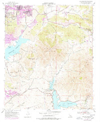
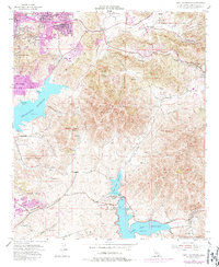
1955 Map of Jamul Mountains
USGS Topo · Published 1978About this map
Sweetwater Reservoir and the Otay Lakes dominate this San Diego County landscape, serving as critical infrastructure for the growing suburban and agricultural communities of the mid-20th century. Residential expansion is clearly visible in the purple-tinted urban extensions of Spring Valley and Casa de Oro, while the eastern and southern portions of the map retain a more rural character defined by expansive ranching operations like Monte Vista Ranch and Ivanhoe Ranch. The map captures a moment of transition where traditional land grants such as Otay (Estudillo) and Otay (Dominguez) meet modern infrastructure. Topographic details reveal the prominence of San Miguel Mountain and Mother Miguel Mtn, which overlook the developing Proctor Valley and Jamul Valley. Educational and social hubs like Southwestern College and The Oaks School appear alongside essential utility sites like the Savage Dam and various water storage facilities, documenting the region's mid-century modernization.
Find a feature on this map
65 named features on this map. Tap any name to fly to it.
Don’t see what you’re looking for? This feature index may not catch every label — zoom into the map to look around manually.
Map Details
Editions of this 1955 Jamul Mountains Map
5 editions found
Other maps of this area

1893 · El Cajon
USGS Topo · 1:62,500

1901 · Elcajon
USGS Topo · 1:62,500

1903 · Cuyamaca
USGS Topo · 1:125,000

1903 · La Jolla
USGS Topo · 1:62,500

1903 · Elcajon
USGS Topo · 1:62,500

1904 · San Diego
USGS Topo · 1:62,500

1904 · Southern California Sheet No. 2
USGS Topo · 1:250,000

1930 · La Jolla
USGS Topo · 1:62,500

1930 · San Diego
USGS Topo · 1:62,500

1939 · El Cajon
USGS Topo · 1:62,500