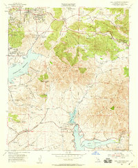
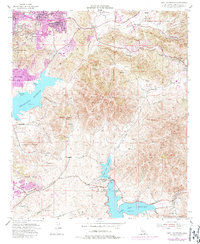
1955 Map of Jamul Mountains
USGS Topo · Published 1959About this map
The San Miguel Mountains and the Jamul Mountains dominate this mid-century landscape east of San Diego, where ranching heritage meets early suburban expansion. Significant water management infrastructure is evident through the presence of the Sweetwater Reservoir, Upper Otay Reservoir, and Lower Otay Reservoir, along with the Jamul Conduit and Savage Dam. This era shows Spring Valley and Casa de Oro beginning to develop along Sweetwater Springs Blvd, while the interior remains defined by sprawling properties like Rancho del Otay, Fenton Ranch, and Ivanhoe Ranch. Local aviation history is preserved at the La Mesa Airport located near Jamacha Junction. Topographic landmarks such as Mother Miguel Mtn, Dictionary Hill, and Gobblers Knob rise above the complex network of canyons including Steere Canyon and Telegraph Canyon, illustrating the challenging terrain that shaped early transportation routes like Campo Road.
Find a feature on this map
53 named features on this map. Tap any name to fly to it.
Don’t see what you’re looking for? This feature index may not catch every label — zoom into the map to look around manually.
Map Details
Editions of this 1955 Jamul Mountains Map
5 editions found
Other maps of this area

1893 · El Cajon
USGS Topo · 1:62,500

1901 · Elcajon
USGS Topo · 1:62,500

1903 · Cuyamaca
USGS Topo · 1:125,000

1903 · La Jolla
USGS Topo · 1:62,500

1903 · Elcajon
USGS Topo · 1:62,500

1904 · San Diego
USGS Topo · 1:62,500

1904 · Southern California Sheet No. 2
USGS Topo · 1:250,000

1930 · La Jolla
USGS Topo · 1:62,500

1930 · San Diego
USGS Topo · 1:62,500

1939 · El Cajon
USGS Topo · 1:62,500