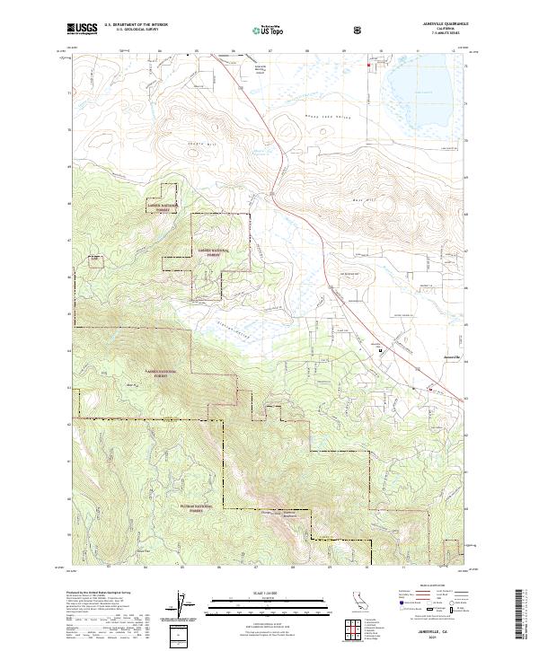
2021 Map of Janesville
USGS Topo · Published 2021About this map
The high desert terrain of the Honey Lake Valley meets the timbered slopes of the Diamond Mountains in this modern topographical record. At the center of the landscape, the town of Janesville sits along the foot of the range, marked by its community cemetery, Janesville Cem, and a network of local roads including Indians Road and Elysian Valley Way. Water management is a defining characteristic of the valley floor, where the Lake Leavitt Inlet Canal feeds into Lake Leavitt and the Shugru Reservoir sits beneath Shugru Hill.
Find a feature on this map
91 named features on this map. Tap any name to fly to it.
Don’t see what you’re looking for? This feature index may not catch every label — zoom into the map to look around manually.
Map Details
Editions of this 2021 Janesville Map
This is the sole edition of this map. No revisions or reprints were ever made.
Other maps of this area

1886 · Honey Lake
USGS Topo · 1:250,000

1891 · Honey Lake
USGS Topo · 1:250,000

1893 · Honey Lake
USGS Topo · 1:250,000

1950 · Kettle Rock
USGS Topo · 1:62,500

1950 · Milford
USGS Topo · 1:62,500

1954 · Susanville
USGS Topo · 1:62,500

1954 · Litchfield
USGS Topo · 1:62,500

1955 · Westwood
USGS Topo · 1:250,000

1958 · Westwood
USGS Topo · 1:250,000

1959 · Westwood
USGS Topo · 1:250,000