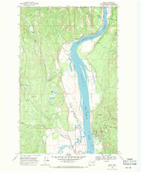
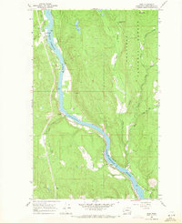
1968 Map of Jared
USGS Topo · Published 1971About this map
The Pend Oreille River serves as the central artery for this portion of northeastern Washington, where the Chicago Milwaukee St Paul and Pacific railroad tracks trace its western bank through the small settlements of Jared and Locke. The geography here transitions from the low-lying river valley to the heights of Ruby Mtn, showing a landscape defined by both timber resources and specialized land use. Notable landmarks include the USAF Survival School and the Manresa Grotto, the latter situated near Gibraltar Rock.
Find a feature on this map
36 named features on this map. Tap any name to fly to it.
Don’t see what you’re looking for? This feature index may not catch every label — zoom into the map to look around manually.
Map Details
Editions of this 1968 Jared Map
Other maps of this area

1934 · Metaline
USGS Topo · 1:125,000

1936 · Newport
USGS Topo · 1:96,000

1942 · Metaline
USGS Topo · 1:125,000

1942 · Newport
USGS Topo · 1:125,000

1958 · Sandpoint
USGS Topo · 1:250,000

1963 · Sandpoint
USGS Topo · 1:250,000

1967 · Timber Mtn.
USGS Topo · 1:24,000
1967 · North Baldy
USGS Topo · 1:24,000
1967 · Ruby
USGS Topo · 1:24,000

1968 · Cusick
USGS Topo · 1:24,000