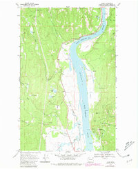
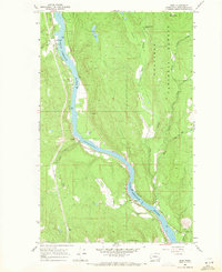
1968 Map of Jared
USGS Topo · Published 1981About this map
The Pend Oreille River bisects this landscape, serving as a corridor for the Chicago Milwaukee St Paul and Pacific railroad and defining the western boundary of the Kalispel Indian Reservation. Small settlements like Jared and Riverside Camp occupy the river's edge, reflecting a period when rail and water access dictated local growth. The presence of the USAF Survival School and the Grange Hall suggests a community that balanced military utility with established agricultural social structures.
Find a feature on this map
44 named features on this map. Tap any name to fly to it.
Don’t see what you’re looking for? This feature index may not catch every label — zoom into the map to look around manually.
Map Details
Editions of this 1968 Jared Map
Other maps of this area

1934 · Metaline
USGS Topo · 1:125,000

1936 · Newport
USGS Topo · 1:96,000

1942 · Metaline
USGS Topo · 1:125,000

1942 · Newport
USGS Topo · 1:125,000

1958 · Sandpoint
USGS Topo · 1:250,000

1963 · Sandpoint
USGS Topo · 1:250,000

1967 · Timber Mtn.
USGS Topo · 1:24,000
1967 · North Baldy
USGS Topo · 1:24,000
1967 · Ruby
USGS Topo · 1:24,000

1968 · Cusick
USGS Topo · 1:24,000