
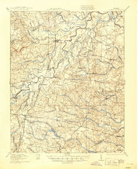
1919 Map of Jarratt
USGS Topo · Published 1919About this map
The Nottoway River and its dense network of swamps, including Island Swamp and Cabin Point Swamp, dominate this Tidewater landscape at the end of the first World War. The region is characterized by a reliance on timber and agriculture, evidenced by Pedneans Stave Mill and the numerous family-named mills like Winfields Mill and Howells Mill. The rail corridor of the Virginian and Southern railroads serves as the primary artery for local commerce, connecting settlements like Jarratt and Stony Creek to broader markets. Genealogists can find a wealth of community centers, from the Russian Church to the Yalax School, alongside smaller rural stops like Owens Store and Tyus Store. The intricate mapping of small branches like Mortar Branch and Black Branch illustrates the water-heavy terrain that shaped the boundaries between Sussex, Greensville, and Dinwiddie counties.
Find a feature on this map
76 named features on this map. Tap any name to fly to it.
Don’t see what you’re looking for? This feature index may not catch every label — zoom into the map to look around manually.
Map Details
Editions of this 1919 Jarratt Map
3 editions found
Other maps of this area

1894 · Petersburg
USGS Topo · 1:62,500

1897 · Amelia
USGS Topo · 1:125,000

1919 · Jarratt
USGS Topo · 1:62,500

1919 · Mc Kenney
USGS Topo · 1:48,000

1919 · Disputanta
USGS Topo · 1:62,500

1919 · Homeville
USGS Topo · 1:48,000

1919 · Boykins
USGS Topo · 1:48,000

1919 · Emporia
USGS Topo · 1:62,500

1919 · Arringdale
USGS Topo · 1:48,000

1920 · Homeville
USGS Topo · 1:62,500