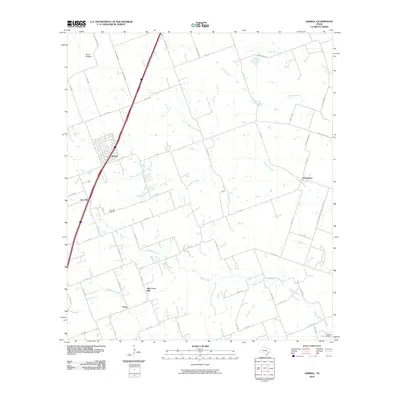
2010 Map of Jarrell
USGS Topo · Published 2010About this map
Jarrell and the surrounding agricultural lands of Williamson County are defined by a network of farm-to-market roads and prairie creeks. This 2010 survey illustrates the proximity of historical hamlets that shaped the region’s early development, including Corn Hill, Schwertner, New Corn Hill, and Theon. The landscape is etched with the drainage patterns of Donahoe Creek, Willis Creek, and Opossum Creek, which have historically dictated the placement of homesteads and grazing land.
Find a feature on this map
62 named features on this map. Tap any name to fly to it.
Don’t see what you’re looking for? This feature index may not catch every label — zoom into the map to look around manually.
Map Details
Editions of this 2010 Jarrell Map
This is the sole edition of this map. No revisions or reprints were ever made.
Other maps of this area

1885 · Taylor
USGS Topo · 1:125,000

1887 · Taylor
USGS Topo · 1:125,000

1893 · Georgetown
USGS Topo · 1:125,000

1894 · Taylor
USGS Topo · 1:125,000

1925 · Georgetown 4-b
USGS Topo · 1:48,000

1928 · Round Rock
USGS Topo · 1:62,500

1949 · Round Rock
USGS Topo · 1:62,500

1951 · Round Rock
USGS Topo · 1:62,500

1954 · Austin
USGS Topo · 1:250,000
1958 · Youngsport
USGS Topo · 1:24,000