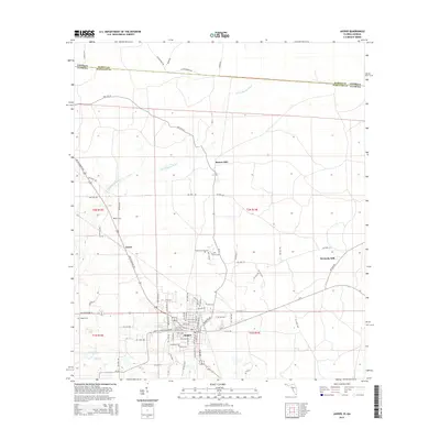
2015 Map of Jasper
USGS Topo · Published 2015About this map
Jasper serves as the seat of Hamilton County, positioned just south of the Georgia-Florida state line. This 2015 study details a landscape defined by its agricultural roots and dispersed rural communities like Rawls, Kennedy Still, and Bakers Mill. The winding course of the Little Alapaha River moves across the northern sections, while Tiger Cr and Clardy Lakes sit to the southwest. Genealogists will find several notable burial grounds throughout the area, including Evergreen Cem on the edge of town and the more remote White Chimney Cem. The map illustrates a developed transportation network where NW US Highway 41 and NW US Highway 129 intersect, providing a clear view of the modern layout of Jasper's residential streets, including Martin Luther King Jr SW and Palmetto Ave.
Find a feature on this map
36 named features on this map. Tap any name to fly to it.
Don’t see what you’re looking for? This feature index may not catch every label — zoom into the map to look around manually.
Map Details
Editions of this 2015 Jasper Map
This is the sole edition of this map. No revisions or reprints were ever made.
Other maps of this area

1954 · Valdosta
USGS Topo · 1:250,000

1955 · Jasper
USGS Topo · 1:24,000

1955 · Cypress Creek
USGS Topo · 1:24,000

1956 · Jennings
USGS Topo · 1:24,000

1958 · Valdosta
USGS Topo · 1:250,000

1958 · Fort Union
USGS Topo · 1:24,000

1959 · Valdosta
USGS Topo · 1:250,000

1961 · Hillcoat
USGS Topo · 1:24,000

1962 · Genoa
USGS Topo · 1:24,000

1971 · Tarver
USGS Topo · 1:24,000