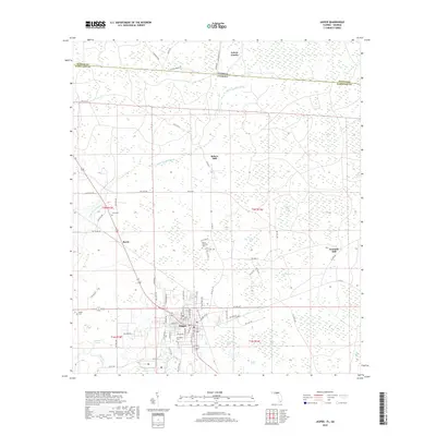
2018 Map of Jasper
USGS Topo · Published 2018About this map
The Georgia Florida state line defines the northern boundary of this 2018 survey, where the Little Alapaha River cuts through the wet, forested interior of Hamilton County. The landscape is characterized by numerous bay systems and swamps, including the curiously named Schoolhouse Bay, Buzzard Bay, and the extensive Basin Swamp to the south. Historically significant nodes are scattered across the terrain, from the timber-related name of Kennedy Still to the community at Bakers Mill. The city of Jasper serves as the primary hub, showing a grid of streets and local landmarks such as Evergreen Cem. This contemporary mapping preserves the locations of rural burying grounds like White Chimney Cem and Nunn Cem, which remain vital for family historians tracing North Florida roots. The presence of Roberts Point and Shaky Pond amidst the marshy wetlands illustrates the complex drainage patterns of this river-valley region.
Find a feature on this map
93 named features on this map. Tap any name to fly to it.
Don’t see what you’re looking for? This feature index may not catch every label — zoom into the map to look around manually.
Map Details
Editions of this 2018 Jasper Map
This is the sole edition of this map. No revisions or reprints were ever made.
Other maps of this area

1954 · Valdosta
USGS Topo · 1:250,000

1955 · Jasper
USGS Topo · 1:24,000

1955 · Cypress Creek
USGS Topo · 1:24,000

1956 · Jennings
USGS Topo · 1:24,000

1958 · Valdosta
USGS Topo · 1:250,000

1958 · Fort Union
USGS Topo · 1:24,000

1959 · Valdosta
USGS Topo · 1:250,000

1961 · Hillcoat
USGS Topo · 1:24,000

1962 · Genoa
USGS Topo · 1:24,000

1971 · Tarver
USGS Topo · 1:24,000