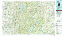
1994 Map of Jasper
USGS Topo · Published 1994About this map
The Ohio River carves a winding path along the southern border of this landscape, framing the wooded hills and sprawling public lands of southern Indiana. The interior is defined by vast tracts of the Hoosier National Forest and the significant waters of Patoka Lake, where the Patoka Lake State Recreation Area marks a major regional destination. Settlement patterns here reflect deep religious and communal roots, evidenced by landmarks like the Saint Meinrad Archabbey and numerous Catholic parish centers such as Saint Anthony Church and Saint Marks Church.
Find a feature on this map
188 named features on this map. Tap any name to fly to it.
Don’t see what you’re looking for? This feature index may not catch every label — zoom into the map to look around manually.
Map Details
Editions of this 1994 Jasper Map
This is the sole edition of this map. No revisions or reprints were ever made.
Other maps of this area

1900 · St Meinrad
USGS Topo · 1:62,500

1900 · De Gonia Springs
USGS Topo · 1:62,500

1901 · Owensboro
USGS Topo · 1:62,500

1902 · Ditney
USGS Topo · 1:125,000

1902 · Degonia Springs
USGS Topo · 1:62,500

1903 · St. Meinrad
USGS Topo · 1:62,500

1903 · Velpen
USGS Topo · 1:62,500

1903 · Tell City
USGS Topo · 1:62,500

1909 · Kosmosdale
USGS Topo · 1:48,000

1912 · Kosmosdale
USGS Topo · 1:62,500