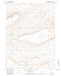
1966 Map of Jawbone Ranch
USGS Topo · Published 1981About this map
Jawbone Ranch serves as a lonely landmark in this high-plains landscape of Sweetwater County, situated near the Riner Cutoff Road. The topography is dominated by the broad, elevated plateau of Windy Hill, which sits between the seasonal drainages of Buck Draw to the north and Creston Draw to the south. This 1960s-era survey, updated in the early 1980s, reveals a landscape defined by industrial and agricultural utility, marked by a traversing Pipeline and isolated features like a Corral and Well. The inclusion of a small Landing Strip near the center of the sheet highlights the immense distances and remote character of this part of Wyoming, where air travel and specialized roads were essential for managing ranching and utility operations across the high desert terrain.
Find a feature on this map
10 named features on this map. Tap any name to fly to it.
Don’t see what you’re looking for? This feature index may not catch every label — zoom into the map to look around manually.
Map Details
Editions of this 1966 Jawbone Ranch Map
2 editions found
Other maps of this area

1954 · Rawlins
USGS Topo · 1:250,000

1958 · Rawlins
USGS Topo · 1:250,000

1960 · Hansen Lake NE
USGS Topo · 1:24,000

1960 · Larsen Knoll
USGS Topo · 1:24,000

1960 · Buck Draw
USGS Topo · 1:24,000

1962 · Rawlins
USGS Topo · 1:250,000

1966 · Jawbone Ranch
USGS Topo · 1:24,000

1966 · Creston Junction
USGS Topo · 1:24,000

1966 · Riner
USGS Topo · 1:24,000

1966 · Creston
USGS Topo · 1:24,000