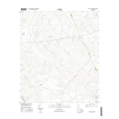
2017 Map of Jay Bird Springs
USGS Topo · Published 2017About this map
Jay Bird Springs anchors the southeastern corner of this Middle Georgia landscape, where the waters of Gum Swamp Creek and Joiner Creek converge near the Laurens and Dodge county line. The terrain is defined by a dense network of tributaries including Little Creek, Granny Branch, and Reedy Branch, which feed into several small impoundments like Cranford Lake and Lake Destiny.
Find a feature on this map
64 named features on this map. Tap any name to fly to it.
Don’t see what you’re looking for? This feature index may not catch every label — zoom into the map to look around manually.
Map Details
Editions of this 2017 Jay Bird Springs Map
This is the sole edition of this map. No revisions or reprints were ever made.
Other maps of this area

1957 · Macon
USGS Topo · 1:250,000

1958 · Macon
USGS Topo · 1:250,000

1964 · Macon
USGS Topo · 1:250,000

1972 · Eastman
USGS Topo · 1:24,000

1972 · Mc Rae NW
USGS Topo · 1:24,000

1972 · Jay Bird Springs
USGS Topo · 1:24,000
1972 · Milan
USGS Topo · 1:24,000
1972 · Mc Rae
USGS Topo · 1:24,000

1972 · Lake Cypress
USGS Topo · 1:24,000

1973 · Cadwell
USGS Topo · 1:24,000