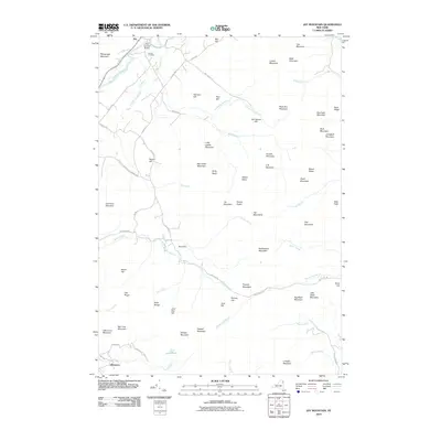
2010 Map of Jay Mountain
USGS Topo · Published 2010About this map
The Jay Covered Bridge spans the East Branch Ausable River at the northern edge of this Adirondack landscape, serving as a historic anchor for the settlement of Jay. The terrain is defined by the high peaks of the Jay Mountains and a series of named ridges including Beech Ridge and Buck Ridge. This 2010 survey details the complex hydrography of the region, where numerous waterways like Styles Brook, Rocky Branch, and Spruce Mill Brook descend from the summits through basins such as Kelly Basin and Gelina Basin.
Find a feature on this map
84 named features on this map. Tap any name to fly to it.
Don’t see what you’re looking for? This feature index may not catch every label — zoom into the map to look around manually.
Map Details
Editions of this 2010 Jay Mountain Map
This is the sole edition of this map. No revisions or reprints were ever made.
Other maps of this area

1894 · Elizabethtown
USGS Topo · 1:62,500

1895 · Elizabethtown
USGS Topo · 1:62,500

1895 · Mt. Marcy
USGS Topo · 1:62,500

1895 · Ausable
USGS Topo · 1:62,500

1896 · Lake Placid
USGS Topo · 1:62,500

1898 · Lake Placid
USGS Topo · 1:62,500

1901 · Elizabethtown
USGS Topo · 1:62,500

1902 · Mt. Marcy
USGS Topo · 1:62,500

1903 · Ausable
USGS Topo · 1:62,500

1950 · Lake Champlain
USGS Topo · 1:250,000