
1971 Map of Jay SE
USGS Topo · Published 1972About this map
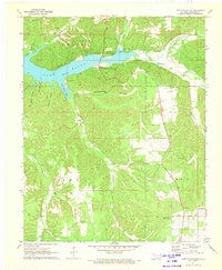
Lake Eucha dominates the northern landscape of this Delaware County survey, where the Dry Creek Arm and Spavinaw Creek meet. The terrain is defined by deeply incised drainages like Teesquatnee Hollow and Coleman Hollow, which create a series of prominent bluffs including Lanes Bluff and Black Fox Bluff. These geographic features represent the intricate drainage patterns of the Ozark Plateau as it appeared in the early 1970s.
Find a feature on this map
24 named features on this map. Tap any name to fly to it.
Don’t see what you’re looking for? This feature index may not catch every label — zoom into the map to look around manually.
Map Details
Editions of this 1971 Jay SE Map
2 editions found
Other maps of this area

1899 · Siloam Springs
USGS Topo · 1:125,000

1903 · Siloam Springs
USGS Topo · 1:125,000

1904 · Siloam Springs
USGS Topo · 1:125,000

1954 · Tulsa
USGS Topo · 1:250,000

1958 · Tulsa
USGS Topo · 1:250,000

1963 · Tulsa
USGS Topo · 1:250,000

1971 · Kenwood
USGS Topo · 1:24,000
1971 · Jay
USGS Topo · 1:24,000
1971 · Sycamore
USGS Topo · 1:24,000
1971 · Chloeta
USGS Topo · 1:24,000