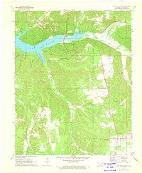
1971 Map of Lake Eucha East
USGS Topo · Published 1973About this map
Lake Eucha dominates this corner of Delaware County, where the impounded waters of Spavinaw Creek reach into deep, winding inlets like Dry Creek Arm and Brush Creek Bay. The surrounding landscape is defined by a dense network of hollows and bluffs, including the notable Teesquatnee Hollow and Black Fox Bluff. This 1970s survey captures the area as a destination for outdoor recreation, centered on the Upper Spavinaw Recreation Area and various campgrounds along the shoreline.
Find a feature on this map
40 named features on this map. Tap any name to fly to it.
Don’t see what you’re looking for? This feature index may not catch every label — zoom into the map to look around manually.
Map Details
Editions of this 1971 Lake Eucha East Map
2 editions found
Other maps of this area

1899 · Siloam Springs
USGS Topo · 1:125,000

1903 · Siloam Springs
USGS Topo · 1:125,000

1904 · Siloam Springs
USGS Topo · 1:125,000

1954 · Tulsa
USGS Topo · 1:250,000

1958 · Tulsa
USGS Topo · 1:250,000

1963 · Tulsa
USGS Topo · 1:250,000

1971 · Kenwood
USGS Topo · 1:24,000

1971 · Jay SE
USGS Topo · 1:24,000
1971 · Jay
USGS Topo · 1:24,000
1971 · Sycamore
USGS Topo · 1:24,000