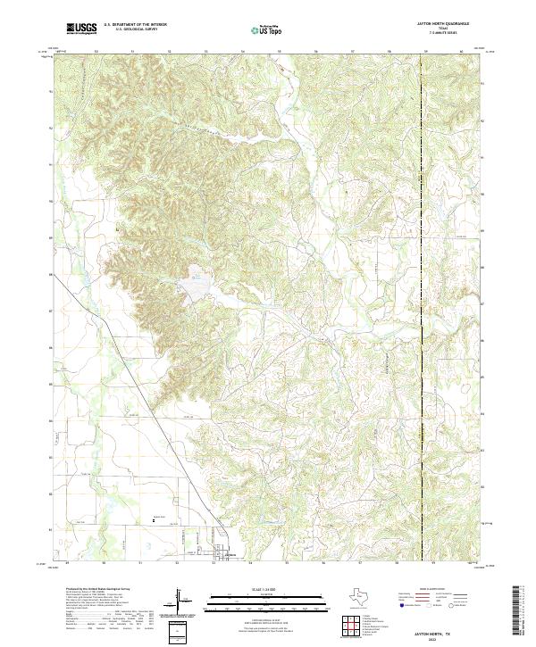
2022 Map of Jayton North
USGS Topo · Published 2022About this map
The town of Jayton anchors the southern edge of this West Texas landscape, where the flat rangelands of the Kent and Stonewall County border meet a highly dissected network of canyons and creeks. North of the town center, the terrain breaks into the complex topography of Hot Springs Canyon and Cedar Canyon, with drainage flowing toward Croton Creek and its various tributaries. This 2022 survey captures the contemporary layout of the community, including the Jayton Cemetery and the grid of residential streets like Van Buren Avenue and Jones Street.
Find a feature on this map
34 named features on this map. Tap any name to fly to it.
Don’t see what you’re looking for? This feature index may not catch every label — zoom into the map to look around manually.
Map Details
Editions of this 2022 Jayton North Map
This is the sole edition of this map. No revisions or reprints were ever made.
Other maps of this area

1954 · Lubbock
USGS Topo · 1:250,000

1958 · Pursley House
USGS Topo · 1:24,000

1958 · Southerland Canyon
USGS Topo · 1:24,000

1958 · Seven Diamond L Canyon
USGS Topo · 1:24,000

1958 · Jayton
USGS Topo · 1:24,000

1959 · Gilpin
USGS Topo · 1:24,000

1959 · Girard
USGS Topo · 1:24,000

1968 · Peacock
USGS Topo · 1:24,000

1969 · Clairemont East
USGS Topo · 1:24,000

1969 · Jayton South
USGS Topo · 1:24,000