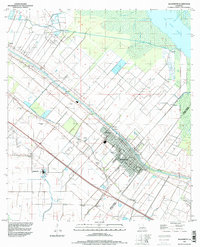
1994 Map of Jeanerette
USGS Topo · Published 1998About this map
Bayou Teche defines the economic and geographic spine of this South Louisiana landscape, its winding course lined with historic settlements like Loisel, Hubertville, and the city of Jeanerette. This 1990s perspective shows the enduring footprint of the sugar industry and water-based commerce, with numerous canals such as the Sandager Canal and Delahoussaye Canal cutting through the lowlands toward Lake Fausse Pointe.
Find a feature on this map
30 named features on this map. Tap any name to fly to it.
Don’t see what you’re looking for? This feature index may not catch every label — zoom into the map to look around manually.
Map Details
Editions of this 1994 Jeanerette Map
This is the sole edition of this map. No revisions or reprints were ever made.
Other maps of this area

1937 · Jeanerette
USGS Topo · 1:62,500

1937 · Derouen
USGS Topo · 1:62,500

1939 · St. Martinsville
USGS Topo · 1:62,500

1941 · Loreauville
USGS Topo · 1:62,500

1945 · New Orleans
USGS Topo · 1:250,000

1954 · Loreauville
USGS Topo · 1:62,500

1954 · Jeanerette
USGS Topo · 1:62,500

1954 · Baton Rouge
USGS Topo · 1:250,000

1956 · Baton Rouge
USGS Topo · 1:250,000

1957 · St. Martinville
USGS Topo · 1:62,500