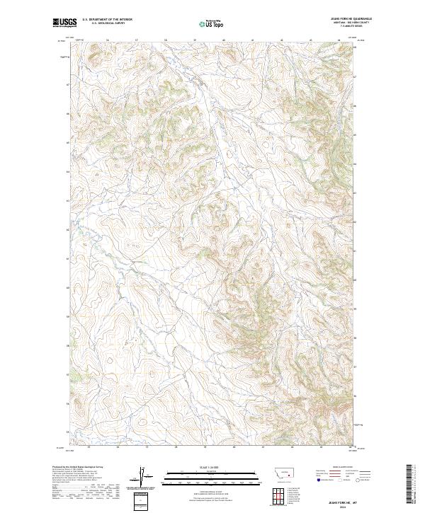
2024 Map of Jeans Fork NE
USGS Topo · Published 2024About this map
Sarpy Creek and its many seasonal tributaries carve through the upland divides of Big Horn County in this modern topographic study. The landscape is defined by the headwaters and drainage basins of several prominent local waterways, including East Fork Tullock Creek to the southwest and the winding course of East Fork Sarpy Creek in the northeast. The map illustrates the complex township and range system, specifically noting the boundaries of t1s r37e, t1s r38e, t2s r37e, and t2s r38e. These survey lines intersect a terrain of ridgelines and draws, such as those surrounding Little Hawk Creek, where the drainage patterns suggest a landscape primarily shaped by livestock grazing and traditional land use rather than dense settlement.
Find a feature on this map
8 named features on this map. Tap any name to fly to it.
Don’t see what you’re looking for? This feature index may not catch every label — zoom into the map to look around manually.
Map Details
Editions of this 2024 Jeans Fork NE Map
This is the sole edition of this map. No revisions or reprints were ever made.
Other maps of this area

1954 · Hardin
USGS Topo · 1:250,000

1957 · Hardin
USGS Topo · 1:250,000

1958 · Hardin
USGS Topo · 1:250,000

1958 · Chalky Point
USGS Topo · 1:24,000

1958 · Busby
USGS Topo · 1:24,000

1967 · Jeans Fork NW
USGS Topo · 1:24,000

1967 · Jeans Fork NE
USGS Topo · 1:24,000
1967 · Jeans Fork SE
USGS Topo · 1:24,000
1967 · Jeans Fork SW
USGS Topo · 1:24,000
1971 · Sarpy School
USGS Topo · 1:24,000