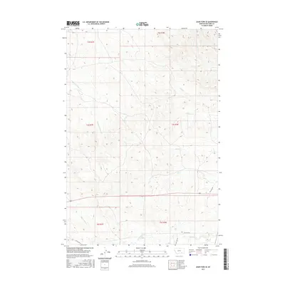
2017 Map of Jeans Fork SE
USGS Topo · Published 2017About this map
Middle Fork Tullock Cr and its various tributaries carve a complex drainage pattern across this Big Horn County landscape. The topography is defined by the divides between seasonal watercourses, including Ash Cr, Deafy Cr, and Teeth Cr, which feed into larger basin systems. This 2017 survey illustrates a sparsely settled region of Montana where land use is dictated by the rugged breaks and coulees of the eastern plains. Access to this remote backcountry is maintained via a handful of unpaved corridors such as Reno Creek Rd and Davis Creek Rd. The map provides a look at the modern-day configuration of Public Land Survey System townships, including t3s r38e and t4s r38e, showing how original homesteading-era boundaries continue to organize the contemporary rural geography.
Find a feature on this map
16 named features on this map. Tap any name to fly to it.
Don’t see what you’re looking for? This feature index may not catch every label — zoom into the map to look around manually.
Map Details
Editions of this 2017 Jeans Fork SE Map
This is the sole edition of this map. No revisions or reprints were ever made.
Other maps of this area

1894 · Rosebud
USGS Topo · 1:125,000

1901 · Rosebud
USGS Topo · 1:125,000

1954 · Hardin
USGS Topo · 1:250,000

1957 · Hardin
USGS Topo · 1:250,000

1958 · Hardin
USGS Topo · 1:250,000

1958 · Chalky Point
USGS Topo · 1:24,000

1958 · Busby
USGS Topo · 1:24,000

1958 · Birdseye Spring
USGS Topo · 1:24,000

1967 · Jeans Fork NW
USGS Topo · 1:24,000

1967 · Jeans Fork NE
USGS Topo · 1:24,000