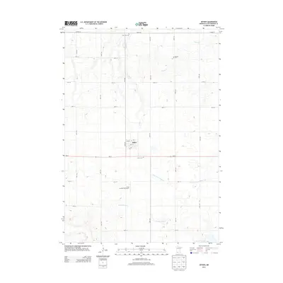
2013 Map of Jeffers
USGS Topo · Published 2013About this map
Jeffers serves as the central hub of this southwestern Minnesota landscape, situated at the intersection of MN-30 and 440th Ave. The surrounding rural territory is defined by a grid of agricultural section roads and the winding paths of several drainage systems, including Mound Cr, Dry Cr, and the Watonwan River. To the south of the main settlement, the Ewen Landing Field Airport provides a rare break in the agricultural pattern.
Find a feature on this map
25 named features on this map. Tap any name to fly to it.
Don’t see what you’re looking for? This feature index may not catch every label — zoom into the map to look around manually.
Map Details
Editions of this 2013 Jeffers Map
This is the sole edition of this map. No revisions or reprints were ever made.
Other maps of this area

1953 · New Ulm
USGS Topo · 1:250,000

1954 · Fairmont
USGS Topo · 1:250,000

1957 · New Ulm
USGS Topo · 1:250,000

1958 · New Ulm
USGS Topo · 1:250,000

1958 · Fairmont
USGS Topo · 1:250,000

1967 · New Ulm
USGS Topo · 1:250,000

1967 · Sanborn
USGS Topo · 1:24,000

1967 · Sanborn SE
USGS Topo · 1:24,000

1967 · Sanborn NE
USGS Topo · 1:24,000

1967 · Storden
USGS Topo · 1:24,000