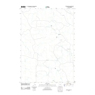
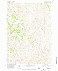
2012 Map of Jeffers Draw
USGS Topo · Published 2012About this map
The Throne Oil Field and Kingsbury Oil Field anchor this 2012 survey of Campbell County, Wyoming, highlighting the industrial footprint of the Powder River Basin. The landscape is defined by an intricate network of drainage systems, including the namesake Jeffers Draw, alongside Bekebrede Draw and Sand Draw. These seasonal waterways feed into larger creeks such as Wild Horse Cr and Kingsbury Cr, reflecting the arid geography of the high plains where water management is critical for local ranching and energy production. Evidence of this is seen in the Boyken Number 2 Reservoir situated in the southeastern corner. Transportation follows the contours of the draws and ridges, with Echeta Rd and Kingsbury Rd providing the primary access points through this energy-rich ranching territory.
Find a feature on this map
17 named features on this map. Tap any name to fly to it.
Don’t see what you’re looking for? This feature index may not catch every label — zoom into the map to look around manually.
Map Details
Editions of this 2012 Jeffers Draw Map
This is the sole edition of this map. No revisions or reprints were ever made.
Other maps of this area

1954 · Gillette
USGS Topo · 1:250,000

1955 · Gillette
USGS Topo · 1:250,000

1958 · Gillette
USGS Topo · 1:250,000

1962 · Gillette
USGS Topo · 1:250,000
1971 · Scott Dam
USGS Topo · 1:24,000

1971 · Oriva NW
USGS Topo · 1:24,000

1971 · Oriva
USGS Topo · 1:24,000
1971 · Four Bar J Ranch
USGS Topo · 1:24,000
1971 · Morgan Draw
USGS Topo · 1:24,000
1972 · Carr Draw
USGS Topo · 1:24,000