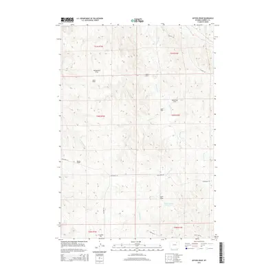
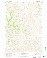
2015 Map of Jeffers Draw
USGS Topo · Published 2015About this map
Kinney Divide and Crenshaw Hill define the high points of this drainage-rich landscape in Wyoming's Powder River Basin. The terrain is characterized by a series of named coulees and draws that channel water toward ephemeral creeks, illustrating the complex natural irrigation patterns of the region. Major water features include the Gates Reservoir in the north and the Boyken Number 2 Reservoir to the south. A network of rural routes, such as Montgomery Rd and Kingsbury Rd, navigate the spaces between Jeffers Draw and Amos Draw, providing access across several townships. The prominence of family-named landmarks like Bekebrede Draw and Sand Draw suggests a history of local land use and ranching in this portion of Campbell County.
Find a feature on this map
26 named features on this map. Tap any name to fly to it.
Don’t see what you’re looking for? This feature index may not catch every label — zoom into the map to look around manually.
Map Details
Editions of this 2015 Jeffers Draw Map
This is the sole edition of this map. No revisions or reprints were ever made.
Other maps of this area

1954 · Gillette
USGS Topo · 1:250,000

1955 · Gillette
USGS Topo · 1:250,000

1958 · Gillette
USGS Topo · 1:250,000

1962 · Gillette
USGS Topo · 1:250,000
1971 · Scott Dam
USGS Topo · 1:24,000

1971 · Oriva NW
USGS Topo · 1:24,000

1971 · Oriva
USGS Topo · 1:24,000
1971 · Four Bar J Ranch
USGS Topo · 1:24,000
1971 · Morgan Draw
USGS Topo · 1:24,000
1972 · Carr Draw
USGS Topo · 1:24,000