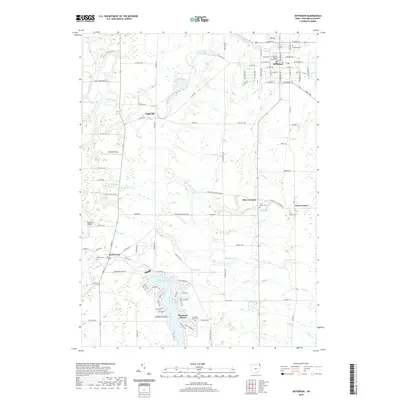
2019 Map of Jefferson
USGS Topo · Published 2019About this map
The Ashtabula County Courthouse stands as the civic anchor of Jefferson, situated within a landscape defined by the winding course of the Grand River. This 2019 survey captures the developed grid of the county seat alongside smaller historical settlements like Lenox Center and Eagleville. The geography is shaped by numerous tributaries including Mill Creek, Badger Run, and Rock Creek, which flow through the predominantly rural outskirts.
Find a feature on this map
105 named features on this map. Tap any name to fly to it.
Don’t see what you’re looking for? This feature index may not catch every label — zoom into the map to look around manually.
Map Details
Editions of this 2019 Jefferson Map
This is the sole edition of this map. No revisions or reprints were ever made.
Other maps of this area

1905 · Andover
USGS Topo · 1:48,000

1905 · Ashtabula
USGS Topo · 1:62,500

1905 · Jefferson
USGS Topo · 1:62,500

1906 · Conneaut
USGS Topo · 1:62,500

1907 · Andover
USGS Topo · 1:62,500

1907 · Jefferson
USGS Topo · 1:62,500

1950 · Cleveland
USGS Topo · 1:250,000

1956 · Cleveland
USGS Topo · 1:250,000

1959 · Dorset
USGS Topo · 1:24,000
1959 · Windsor
USGS Topo · 1:24,000
Featured Places
- Jefferson, OH
- Jefferson Township, OH
- Morgan, Rock Creek
- Morgan Township, OH
- Roaming Shores, Morgan Township