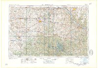
1958 Map of Jefferson City
USGS Topo · Published 1958About this map
The Missouri River and its southern tributaries anchor this mid-century landscape, illustrating the transition from river-based commerce to a post-war economy of aeronautics and recreation. The newly established Whiteman Air Force Base stands as a massive footprint in Johnson County, while the sprawling Lake of the Ozarks dominates the southern reaches, framed by Lake of the Ozarks State Park. These modern developments contrast with established railroad junctions like Sedalia, where the Missouri Pacific and other lines intersect.
Find a feature on this map
55 named features on this map. Tap any name to fly to it.
Don’t see what you’re looking for? This feature index may not catch every label — zoom into the map to look around manually.
Map Details
Editions of this 1958 Jefferson City Map
This is the sole edition of this map. No revisions or reprints were ever made.
Other maps of this area

1884 · Bolivar
USGS Topo · 1:125,000

1885 · Warrensburg
USGS Topo · 1:125,000

1886 · Nevada
USGS Topo · 1:125,000

1886 · Jefferson City
USGS Topo · 1:125,000

1886 · Stockton
USGS Topo · 1:125,000

1887 · Clinton
USGS Topo · 1:125,000

1887 · Harrisonville
USGS Topo · 1:125,000

1887 · Sedalia
USGS Topo · 1:125,000

1887 · Warsaw
USGS Topo · 1:125,000

1887 · Butler
USGS Topo · 1:125,000