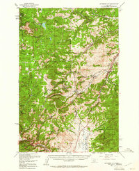
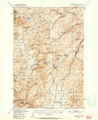
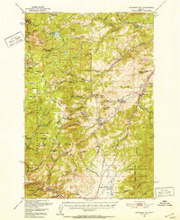
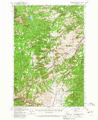
1950 Map of Jefferson City
USGS Topo · Published 1961About this map
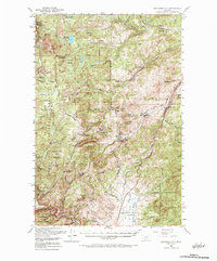
Jefferson City and the mining hamlets of the northern Rocky Mountains are documented here in 1950, showing a landscape defined by extractive industry and high-altitude transport. The map reveals the extensive reach of the mining era, noting several inactive sites such as the Crescent Mine and Alta Mines, alongside active operations like the Free Enterprise Mine. The Great Northern and Northern Pacific railroads provide the primary corridors through the mountainous terrain, following watercourses like Prickly Pear Creek and the Boulder River.
Find a feature on this map
78 named features on this map. Tap any name to fly to it.
Don’t see what you’re looking for? This feature index may not catch every label — zoom into the map to look around manually.
Map Details
Editions of this 1950 Jefferson City Map
5 editions found
Other maps of this area

1886 · Fort Logan
USGS Topo · 1:250,000

1889 · Helena
USGS Topo · 1:250,000

1893 · Helena
USGS Topo · 1:250,000

1899 · Boulder
USGS Topo · 1:125,000

1899 · Helena
USGS Topo · 1:62,500

1899 · Helena
USGS Topo · 1:250,000

1903 · Helena
USGS Topo · 1:250,000

1947 · Butte
USGS Topo · 1:250,000

1948 · White Sulphur Springs
USGS Topo · 1:250,000
1950 · Devils Fence
USGS Topo · 1:62,500