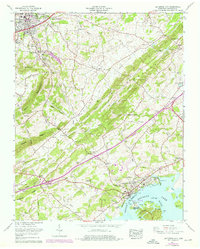
1961 Map of Jefferson City
USGS Topo · Published 1976About this map
Jefferson City and Dandridge anchor this topographic portrait of East Tennessee, connected by the Andrew Johnson Highway as it winds through Dumplin Valley and Hunnicutt Valley. The landscape is defined by the sharp ridges of Bays Mountain and Mutton Ridge, while the southern portion of the sheet is dominated by the broad expanse of Douglas Lake and the French Broad River. This 1974 photorevision highlights mid-century development, including the Carson-Newman College campus and the industrial presence of Coy Mine with its associated tailings pond.
Find a feature on this map
70 named features on this map. Tap any name to fly to it.
Don’t see what you’re looking for? This feature index may not catch every label — zoom into the map to look around manually.
Map Details
Editions of this 1961 Jefferson City Map
3 editions found
Other maps of this area

1883 · Morristown
USGS Topo · 1:125,000

1886 · Knoxville
USGS Topo · 1:125,000

1892 · Knoxville
USGS Topo · 1:125,000

1893 · Mt Guyot
USGS Topo · 1:125,000

1893 · Morristown
USGS Topo · 1:125,000

1894 · Knoxville
USGS Topo · 1:125,000

1895 · Morristown
USGS Topo · 1:125,000

1895 · Knoxville
USGS Topo · 1:125,000

1897 · Maynardville
USGS Topo · 1:125,000

1900 · Maynardville
USGS Topo · 1:125,000