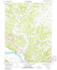
1969 Map of Jefferson City NW
USGS Topo · Published 1986About this map
Cedar Creek winds through the heart of this landscape, marking the boundary between Boone and Callaway counties as it flows toward the Missouri River. To the north, the University of Missouri Ashland Wildlife Research Area covers a significant portion of the upland terrain, characterized by numerous drainage branches such as Middle Branch and Winterbauer Branch. The map reveals a transition from these protected lands to the more developed southern areas, where the town of Holts Summit is beginning to expand.
Find a feature on this map
38 named features on this map. Tap any name to fly to it.
Don’t see what you’re looking for? This feature index may not catch every label — zoom into the map to look around manually.
Map Details
Editions of this 1969 Jefferson City NW Map
3 editions found
Other maps of this area

1886 · Jefferson City
USGS Topo · 1:125,000

1894 · Jefferson City
USGS Topo · 1:125,000

1939 · Jefferson City
USGS Topo · 1:24,000

1939 · Jefferson City
USGS Topo · 1:62,500

1942 · Jefferson City
USGS Topo · 1:62,500

1944 · Millersburg
USGS Topo · 1:62,500

1946 · Millersburg
USGS Topo · 1:62,500

1947 · Jefferson City
USGS Topo · 1:250,000

1948 · Centertown
USGS Topo · 1:62,500

1948 · Columbia
USGS Topo · 1:62,500