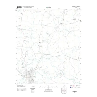
2013 Map of Jefferson
USGS Topo · Published 2013About this map
The Jefferson Historic District anchors this 2013 study of Marion County, where the grid of Jefferson meets the winding course of Big Cypress Bayou. The landscape north of the city is defined by a complex network of waterways, including Black Cypress Bayou, Scotts Cr, and Hasty Cr, reflecting the region's low-lying drainage patterns. This map documents a mix of agricultural heritage and industrial footprints, seen in the northern reach of the Rodessa Oil Field and the rural clusters of Prospect, Hall, and Payne. Local history researchers will find significant genealogical value in the marking of Oakwood Cem, Mt Sinai Cem, and the Old Foundry Cem. Transportation infrastructure like Manning Field Airport and the network of farm-to-market roads, such as FM-248, demonstrate how this historic river port remains connected to the broader East Texas region.
Find a feature on this map
71 named features on this map. Tap any name to fly to it.
Don’t see what you’re looking for? This feature index may not catch every label — zoom into the map to look around manually.
Map Details
Editions of this 2013 Jefferson Map
This is the sole edition of this map. No revisions or reprints were ever made.
Other maps of this area

1944 · Kildare
USGS Topo · 1:62,500

1944 · Caddo Lake
USGS Topo · 1:62,500

1946 · Caddo Lake
USGS Topo · 1:62,500

1948 · Kildare
USGS Topo · 1:62,500

1956 · Tyler
USGS Topo · 1:250,000

1961 · Cunningham Creek
USGS Topo · 1:24,000

1962 · Kellyville
USGS Topo · 1:24,000

1962 · Lanier
USGS Topo · 1:24,000

1962 · Marshall NW
USGS Topo · 1:24,000

1962 · Woodlawn
USGS Topo · 1:24,000