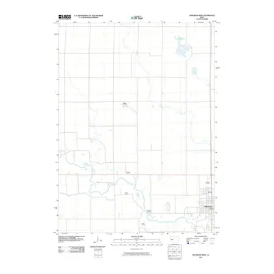
2010 Map of Jefferson West
USGS Topo · Published 2010About this map
Jefferson anchors the southeastern corner of this Greene County landscape, where the local government and civic life are marked by the Jefferson Post Office and the distinctive Mahanay Bell Tower. The surrounding countryside follows a strict section-line grid, typical of Iowa's agricultural heartland, yet is interrupted by the meandering North Raccoon River valley. This drainage system includes Eureka Bridge and numerous small water bodies, culminating in the wetland environment of Goose Lake to the north. For those tracing local heritage, the map identifies several rural burial grounds including Fair Oaks Cemetery, Wright Cemetery, and Headly Cemetery. The small settlement of Farlin sits further west along the rail corridor, representing the smaller grain-handling points that once dotted the region. The map captures the area just as modern infrastructure like road 222nd integrated with long-established landmarks like Golgotha Cemetery.
Find a feature on this map
11 named features on this map. Tap any name to fly to it.
Don’t see what you’re looking for? This feature index may not catch every label — zoom into the map to look around manually.
Map Details
Editions of this 2010 Jefferson West Map
This is the sole edition of this map. No revisions or reprints were ever made.
Other maps of this area

1954 · Bagley
USGS Topo · 1:62,500

1954 · Omaha
USGS Topo · 1:250,000

1954 · Fort Dodge
USGS Topo · 1:250,000

1957 · Omaha
USGS Topo · 1:250,000

1957 · Fort Dodge
USGS Topo · 1:250,000

1958 · Omaha
USGS Topo · 1:250,000

1958 · Fort Dodge
USGS Topo · 1:250,000

1962 · Jefferson
USGS Topo · 1:62,500

1971 · Coon Rapids NE
USGS Topo · 1:24,000

1980 · Wightman
USGS Topo · 1:24,000