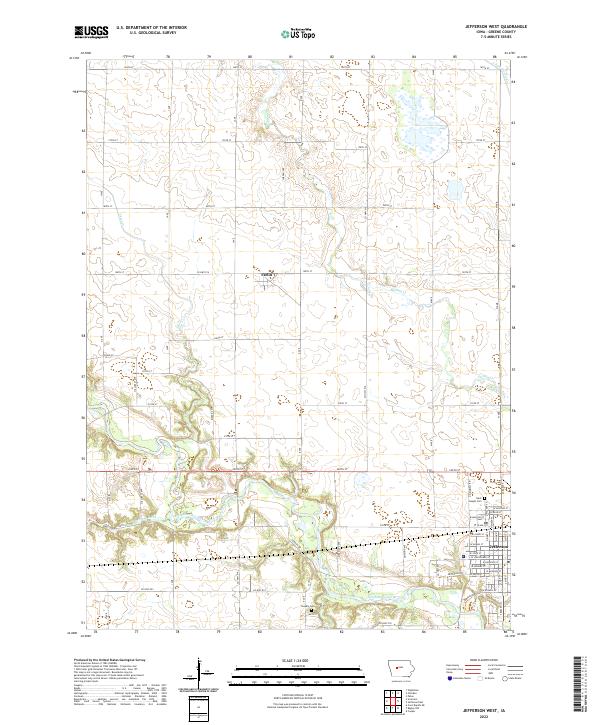
2022 Map of Jefferson West
USGS Topo · Published 2022About this map
The North Raccoon River winds through the southern reaches of Greene County, defining the agricultural and recreational landscape west of Jefferson. This modern topographical study illustrates a region where established farmstead grids meet the natural wandering of Hardin Cr and Short Cr. In the western half of the map, the small community of Farlin sits along Co Hwy P14, serving as a waypoint in a landscape primarily dedicated to industrial-scale cultivation, evidenced by the managed flow of Drainage Ditch 171. Genealogists and local historians can pinpoint long-standing landmarks including Saint Joseph Cem near the town edge and Headly Cem further west. The preservation of natural corridors is highlighted by the Daubendiek Trl, which provides public access to the wooded river bottomlands south of the primary east-west corridor of Co Hwy E53.
Find a feature on this map
45 named features on this map. Tap any name to fly to it.
Don’t see what you’re looking for? This feature index may not catch every label — zoom into the map to look around manually.
Map Details
Editions of this 2022 Jefferson West Map
This is the sole edition of this map. No revisions or reprints were ever made.
Other maps of this area

1954 · Bagley
USGS Topo · 1:62,500

1954 · Omaha
USGS Topo · 1:250,000

1954 · Fort Dodge
USGS Topo · 1:250,000

1957 · Omaha
USGS Topo · 1:250,000

1957 · Fort Dodge
USGS Topo · 1:250,000

1958 · Omaha
USGS Topo · 1:250,000

1958 · Fort Dodge
USGS Topo · 1:250,000

1962 · Jefferson
USGS Topo · 1:62,500

1971 · Coon Rapids NE
USGS Topo · 1:24,000

1980 · Wightman
USGS Topo · 1:24,000