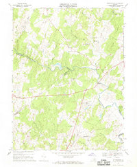
1966 Map of Jeffersonton
USGS Topo · Published 1969About this map
The Rappahannock River serves as the central artery and county boundary on this mid-century survey, winding between Fauquier, Rappahannock, and Culpeper Counties. The settlement pattern reflects a deeply rooted rural landscape, anchored by established hamlets like Jeffersonton and Amissville. Local life revolves around a network of country churches, including Providence Ch near the northern boundary and Rising Zion Ch in the south, while Cliff Mills and Waterloo sit along the river's path, marking historic points of transit and industry.
Find a feature on this map
38 named features on this map. Tap any name to fly to it.
Don’t see what you’re looking for? This feature index may not catch every label — zoom into the map to look around manually.
Map Details
Editions of this 1966 Jeffersonton Map
3 editions found
Other maps of this area

1893 · Luray
USGS Topo · 1:125,000

1894 · Warrenton
USGS Topo · 1:125,000

1894 · Warrenton
USGS Topo · 1:62,500

1905 · Luray
USGS Topo · 1:125,000

1927 · Remington
USGS Topo · 1:48,000

1930 · Warrenton
USGS Topo · 1:62,500

1939 · Front Royal
USGS Topo · 1:48,000

1943 · Orlean
USGS Topo · 1:24,000

1943 · Marshall
USGS Topo · 1:24,000
1944 · Marshall
USGS Topo · 1:31,680