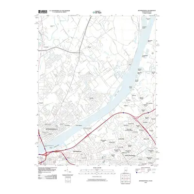
2010 Map of Jeffersonville
USGS Topo · Published 2010About this map
The Ohio River serves as the central artery for this 2010 topographic portrait of the border between Indiana and Kentucky, separating Jeffersonville and Louisville. A series of riverfront communities including Transylvania Beach, Longview Beach, and Juniper Beach line the eastern banks, while the northern Indiana side shows a mixture of residential density and industrial infrastructure near the Clark County Airport. The landscape is notable for its numerous educational and commemorative sites, from the Ottawa University Indiana Campus to the Zachary Taylor National Cemetery near Winding Falls.
Find a feature on this map
113 named features on this map. Tap any name to fly to it.
Don’t see what you’re looking for? This feature index may not catch every label — zoom into the map to look around manually.
Map Details
Editions of this 2010 Jeffersonville Map
This is the sole edition of this map. No revisions or reprints were ever made.
Other maps of this area

1905 · Prospect
USGS Topo · 1:62,500

1907 · Louisville
USGS Topo · 1:62,500

1909 · Kosmosdale
USGS Topo · 1:48,000

1912 · Prospect
USGS Topo · 1:62,500

1912 · Kosmosdale
USGS Topo · 1:62,500

1937 · Jeffersonville
USGS Topo · 1:24,000

1937 · Charlestown
USGS Topo · 1:24,000

1938 · Owen
USGS Topo · 1:24,000

1938 · Speed
USGS Topo · 1:24,000

1939 · New Albany
USGS Topo · 1:24,000