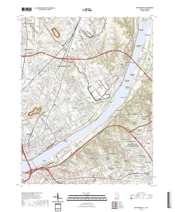
2022 Map of Jeffersonville
USGS Topo · Published 2022About this map
The Ohio River serves as the central artery and state boundary in this 2022 survey, dividing Jeffersonville, Indiana, from the northern neighborhoods of Louisville, Kentucky. This contemporary map documents the dense suburban development of the early 21st century, showing how the landscape is tied together by major interstates including I-65, I-265, and I-71. On the Indiana side, the historic grid of Port Fulton and the governmental hub at the Clark County Government Building contrast with the sprawling industrial and residential corridors extending toward Sellersburg and Watson.
Find a feature on this map
81 named features on this map. Tap any name to fly to it.
Don’t see what you’re looking for? This feature index may not catch every label — zoom into the map to look around manually.
Map Details
Editions of this 2022 Jeffersonville Map
This is the sole edition of this map. No revisions or reprints were ever made.
Other maps of this area

1905 · Prospect
USGS Topo · 1:62,500

1907 · Louisville
USGS Topo · 1:62,500

1909 · Kosmosdale
USGS Topo · 1:48,000

1912 · Prospect
USGS Topo · 1:62,500

1912 · Kosmosdale
USGS Topo · 1:62,500

1937 · Jeffersonville
USGS Topo · 1:24,000

1937 · Charlestown
USGS Topo · 1:24,000

1938 · Owen
USGS Topo · 1:24,000

1938 · Speed
USGS Topo · 1:24,000

1939 · New Albany
USGS Topo · 1:24,000