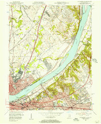
1955 Map of Jeffersonville
USGS Topo · Published 1957About this map
The Ohio River forms the central spine of this mid-century portrait, dividing the expanding industrial and residential landscapes of southern Indiana and northern Kentucky. On the northern bank, Jeffersonville is anchored by the U S Military Reservation (Indiana Arsenal) and the extensive rail yards of the Pennsylvania RR and Baltimore and Ohio RR. The landscape transitions from the dense urban core near the Big Four RR Bridge to suburban developments like Oak Park and Eastern Heights.
Find a feature on this map
91 named features on this map. Tap any name to fly to it.
Don’t see what you’re looking for? This feature index may not catch every label — zoom into the map to look around manually.
Map Details
Editions of this 1955 Jeffersonville Map
This is the sole edition of this map. No revisions or reprints were ever made.
Other maps of this area

1905 · Prospect
USGS Topo · 1:62,500

1907 · Louisville
USGS Topo · 1:62,500

1909 · Kosmosdale
USGS Topo · 1:48,000

1912 · Prospect
USGS Topo · 1:62,500

1912 · Kosmosdale
USGS Topo · 1:62,500

1937 · Jeffersonville
USGS Topo · 1:24,000

1937 · Charlestown
USGS Topo · 1:24,000

1938 · Owen
USGS Topo · 1:24,000

1938 · Speed
USGS Topo · 1:24,000

1939 · New Albany
USGS Topo · 1:24,000