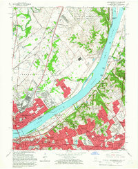
1965 Map of Jeffersonville
USGS Topo · Published 1966About this map
The Ohio River acts as the central spine of this mid-1960s survey, dividing the industrial and suburban growth of Jeffersonville, Indiana, from the expanding neighborhoods of Louisville, Kentucky. On the Indiana side, the massive U S Military Reservation Indiana Arsenal dominates the northern landscape, while the Pennsylvania Railroad and Baltimore and Ohio Railroad facilitate heavy industry near Cementville. Across the water, the Kentucky shoreline reveals a densely developed suburban pattern, featuring numerous incorporated enclaves like Windy Hills and Indian Hills. Notable institutional landmarks are prominent throughout, including the Zachary Taylor National Cemetery and the Locust Grove Historical Home. The presence of the John F Kennedy Memorial Bridge and Municipal Harbor underscores the river's enduring role in regional transport and commerce.
Find a feature on this map
120 named features on this map. Tap any name to fly to it.
Don’t see what you’re looking for? This feature index may not catch every label — zoom into the map to look around manually.
Map Details
Editions of this 1965 Jeffersonville Map
2 editions found
Other maps of this area

1905 · Prospect
USGS Topo · 1:62,500

1907 · Louisville
USGS Topo · 1:62,500

1909 · Kosmosdale
USGS Topo · 1:48,000

1912 · Prospect
USGS Topo · 1:62,500

1912 · Kosmosdale
USGS Topo · 1:62,500

1937 · Jeffersonville
USGS Topo · 1:24,000

1937 · Charlestown
USGS Topo · 1:24,000

1938 · Owen
USGS Topo · 1:24,000

1938 · Speed
USGS Topo · 1:24,000

1939 · New Albany
USGS Topo · 1:24,000