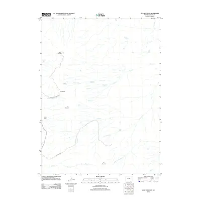
2012 Map of Jelm Mountain
USGS Topo · Published 2012About this map
Jelm Mountain dominates this portion of Albany County, anchoring a landscape shaped by high-altitude ranching and rugged drainages. The 2012 survey illustrates the sparse settlement of the era, centered on landmarks like the Cole Ranch and a network of mountain passes, including Sunrise Pass. The hydrology of the area is defined by seasonal and perennial flows such as Dickey Cr and Lindsey Cr, alongside human-engineered features like the Old King Ditch and the twin reservoirs of Ring Lake Number 1 and Ring Lake Number 2.
Find a feature on this map
24 named features on this map. Tap any name to fly to it.
Don’t see what you’re looking for? This feature index may not catch every label — zoom into the map to look around manually.
Map Details
Editions of this 2012 Jelm Mountain Map
This is the sole edition of this map. No revisions or reprints were ever made.
Other maps of this area

1895 · Laramie
USGS Topo · 1:125,000

1902 · Laramie
USGS Topo · 1:125,000

1905 · Laramie
USGS Topo · 1:125,000

1906 · Medicine Bow
USGS Topo · 1:125,000

1906 · Laramie
USGS Topo · 1:125,000

1908 · Laramie
USGS Topo · 1:125,000

1908 · Medicine Bow
USGS Topo · 1:125,000

1916 · Home
USGS Topo · 1:125,000

1920 · Home
USGS Topo · 1:125,000

1954 · Cheyenne
USGS Topo · 1:250,000