
1943 Map of Jemez
USGS Topo · Published 1943About this map
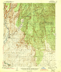
Jemez and the surrounding pueblo lands are shown here in the late 1930s, revealing a landscape defined by ancestral boundaries and early industrial infrastructure. The presence of the Santa Fe Northwestern (RR Abandoned) tracks along the Jemez River signals the transition from active rail commerce to a quieter era. This survey also records the Paliza C C C Camp within the Santa Fe National Forest, marking the era of federal conservation labor in the New Mexico backcountry.
Find a feature on this map
60 named features on this map. Tap any name to fly to it.
Don’t see what you’re looking for? This feature index may not catch every label — zoom into the map to look around manually.
Map Details
Editions of this 1943 Jemez Map
4 editions found
Other maps of this area

1888 · Bernalillo
USGS Topo · 1:125,000

1889 · Albuquerque
USGS Topo · 1:125,000

1890 · Jemes
USGS Topo · 1:125,000

1892 · San Pedro
USGS Topo · 1:125,000

1892 · Jemes
USGS Topo · 1:125,000

1892 · Santa Clara
USGS Topo · 1:125,000

1893 · Albuquerque
USGS Topo · 1:125,000

1937 · Jemez Springs
USGS Topo · 1:48,000

1939 · La Ventana
USGS Topo · 1:62,500

1939 · San Ysidro
USGS Topo · 1:62,500