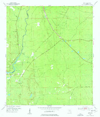
1954 Map of Jena
USGS Topo · Published 1976About this map
The Steinhatchee River defines the border between Taylor and Dixie Counties, anchoring a low-lying coastal landscape of wet timberlands and small settlements in the mid-1950s. Near the river's bend, the community of Jena is established with the Jena Sch and nearby Steinhatchee Cem, while the inland settlement of Jonesboro sits further east along the highway. The geography is dominated by extensive drainage networks including Pumpkin Swamp and Pine Log Swamp, revealing the difficult terrain navigated by early residents.
Find a feature on this map
21 named features on this map. Tap any name to fly to it.
Don’t see what you’re looking for? This feature index may not catch every label — zoom into the map to look around manually.
Map Details
Editions of this 1954 Jena Map
3 editions found
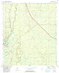
Other maps of this area

1954 · Steinhatchee SW
USGS Topo · 1:24,000

1954 · Cross City West
USGS Topo · 1:24,000

1954 · Clara
USGS Topo · 1:24,000

1954 · Salem SW
USGS Topo · 1:24,000

1954 · Mallory Swamp SW
USGS Topo · 1:24,000

1954 · Jena
USGS Topo · 1:24,000

1954 · Steinhatchee
USGS Topo · 1:24,000

1954 · Steinhatchee SE
USGS Topo · 1:24,000

1954 · Cross City SW
USGS Topo · 1:24,000

1954 · Gainesville
USGS Topo · 1:250,000