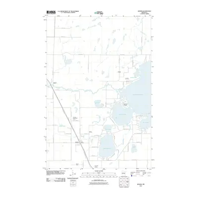
2010 Map of Jenkins
USGS Topo · Published 2010About this map
Jenkins sits at a crossroads of recreational and residential growth in Crow Wing County, where the Paul Bunyan Trl follows an old rail corridor past the Jenkins Post Office. The landscape is dominated by a complex chain of lakes including Upper Hay Lake, Lower Hay Lake, and the expansive Upper Whitefish Lake. These water bodies are connected by natural drainage systems like Hay Creek and the meandering Pine River, which passes near the River View RV Park.
Find a feature on this map
56 named features on this map. Tap any name to fly to it.
Don’t see what you’re looking for? This feature index may not catch every label — zoom into the map to look around manually.
Map Details
Editions of this 2010 Jenkins Map
This is the sole edition of this map. No revisions or reprints were ever made.
Other maps of this area

1953 · Brainerd
USGS Topo · 1:250,000

1957 · Brainerd
USGS Topo · 1:250,000

1958 · Brainerd
USGS Topo · 1:250,000

1959 · Pelican Lake
USGS Topo · 1:24,000

1959 · Nisswa
USGS Topo · 1:24,000

1959 · Lower Whitefish Lake
USGS Topo · 1:24,000

1959 · Pine River
USGS Topo · 1:24,000

1959 · Jenkins
USGS Topo · 1:24,000

1959 · Pine River SW
USGS Topo · 1:24,000

1965 · Brainerd
USGS Topo · 1:250,000