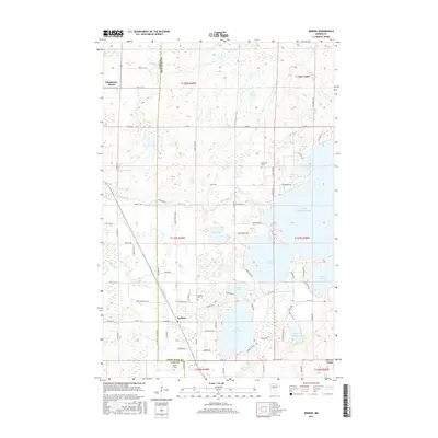
2016 Map of Jenkins
USGS Topo · Published 2016About this map
Upper Whitefish Lake and a dense network of smaller basins like Upper Hay Lake and Rat Lake dominate this portion of the Minnesota lake country. The terrain is a complex of wetlands and timbered rises, including White Pine Knoll, illustrating the glacial topography of the Cass and Crow Wing county line. Small settlements such as Jenkins and Chickamaw Beach are connected by a grid of county roads and historic trails that follow the natural contours of the land.
Find a feature on this map
83 named features on this map. Tap any name to fly to it.
Don’t see what you’re looking for? This feature index may not catch every label — zoom into the map to look around manually.
Map Details
Editions of this 2016 Jenkins Map
This is the sole edition of this map. No revisions or reprints were ever made.
Other maps of this area

1953 · Brainerd
USGS Topo · 1:250,000

1957 · Brainerd
USGS Topo · 1:250,000

1958 · Brainerd
USGS Topo · 1:250,000

1959 · Pelican Lake
USGS Topo · 1:24,000

1959 · Nisswa
USGS Topo · 1:24,000

1959 · Lower Whitefish Lake
USGS Topo · 1:24,000

1959 · Pine River
USGS Topo · 1:24,000

1959 · Jenkins
USGS Topo · 1:24,000

1959 · Pine River SW
USGS Topo · 1:24,000

1965 · Brainerd
USGS Topo · 1:250,000